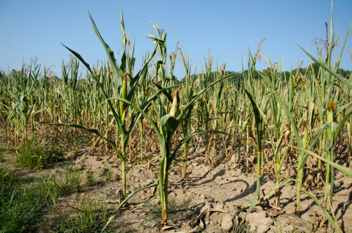
The El Niño phenomenon is weakening although its most obvious manifestations of hotter and drier conditions will continue to be felt across the country, according to the Philippine Atmospheric Geophysical and Astronomical Services Administration or PAG-ASA.
This develops even as PAG-ASA meteorologists closely monitor the situation for indications of an early onset of the La Nina when the waters of Central and Eastern Pacific Oceans cool down, bringing with it above average rainfall as destructive or even more than El Nino.
Rusy Abastillas, senior weather specialist at the PAG-ASA, said in an online briefing that there have been signs of cooling across most of the equatorial Pacific Ocean the last four weeks, indicating the weakening of El Niño.
But even as El Niño is waning, its effects will continue to be notable until May, Abastillas said in her mid-week update. “There is about 95 percent probability [that] this El Niño, although weak, will continue until the March-April-May season.”
She explained the PAG-ASA expects the likely transition from El Niño to El Niño-Southern Oscillation (ENSO)-neutral—referring to those periods when neither El Niño nor La Niña is present—“from April, May, June up to May-June-July, at more than 70 percent probability.”
According to her, this will be followed by the increasing odds (at least 60 percent chance) of La Niña developing in the June-July-August 2024 season up to November, December, and January 2025.
El Niño and La Niña represent opposite extremes in the naturally occurring climate cycle referred to as El Niño-Southern Oscillation (ENSO).
El Niño refers to a periodic weather event characterized by a warming of the ocean surface or above-average sea surface temperatures in the eastern equatorial Pacific. It is associated with droughts, heat waves, heavy rainfall and other extreme weather events. La Niña is usually associated with lower-than-normal air pressure, which brings above-normal rainfall conditions.
Abastillas said that historically, a pre-developing La Niña is characterized by below-normal rainfall. “Therefore the possibility of a slight delay in the onset of the rainy season is likely with the combined effects of the ongoing El Niño,” she said.
“So we still expect lower rainfall volume this coming rainy season,” she continued.
Abastillas said meteorologists forecast 10 to 13 tropical cyclones entering or developing within the so-called Philippine Area of Responsibility from May to October 2024.
She also gave updated forecasts on prevailing temperatures from May to October, noting that “below-average to warmer-than-average surface air temperatures are expected throughout the country during the forecast period,” she warned.
Miguel Adrian Garcia of the Philippine Disaster Resilience Foundation in his presentation said the Philippines faces “extremes during this time of the ENSO phenomenon.”
He observed that even as the El Niño phase is weakening, “we’re still expecting above-normal temperatures… and we’re still going to have dry spells and droughts all over the country.”
And as El Niño transitions to La Niña, “we’re expecting below-normal rainfall and delay of the onset of the rainy season, but with the decrease we are still expecting heavy rainfall during the habagat season,” he added.
He said above-normal rainfall could come as early as October 2024, coinciding with the peak of the tropical cyclone season.
Garcia said the Philippines could be visited by 13 to 16 tropical cyclones up to the end of the year, fewer than the 19 or 20 cyclones on average in recent past.


