



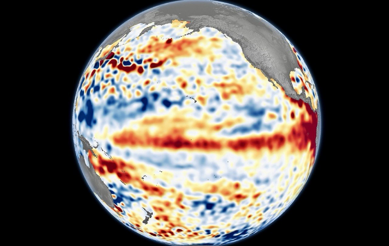
When people hear El Niño, they often picture wilting crops, shrinking reservoirs and relentless heat. That’s only part of the story. Behind the dry skies is a giant oceanic reshuffling that begins thousands of kilometers away in the Pacific and quietly rewrites weather patterns across the globe.
Think of the Pacific Ocean as Earth’s giant thermostat. Under normal conditions, steady trade winds push warm ocean water westward toward Southeast Asia, where it helps fuel towering rain clouds over the Philippines and neighboring countries.
During El Niño, those winds weaken. The warm water drifts back toward the central and eastern Pacific, taking much of the moisture with it. Like a conveyor belt suddenly reversing direction, the atmosphere shifts, leaving the Philippines with hotter days, fewer rainy spells and a greater risk of drought.
That ripple effect reaches far beyond the weather forecast. Farmers struggle with drying fields, reservoirs recede, hydropower plants generate less electricity and communities face tighter water supplies. Crops become more vulnerable to heat stress, while prolonged dry conditions can fuel wildfires and drive up food prices.
But here’s where El Niño delivers an unexpected twist.
If it brings drier weather, why do typhoons still happen?
Because typhoons don’t need rainy seasons. They need warm oceans, and the western Pacific remains warm enough to power tropical cyclones even during El Niño. While the phenomenon usually reduces the number of storms that form near the Philippines by creating less favorable atmospheric conditions, it does not stop them altogether.
Sometimes fewer cyclones develop, but those that do can still unleash torrential rains, floods, landslides and destructive winds. One powerful typhoon is enough to turn a dry season into a disaster zone overnight.
El Niño is not a rare event. It typically develops every two to seven years and usually lasts nine to 12 months, although some episodes persist even longer. Over the past two decades, the world has experienced several notable El Niño episodes, including those in 2004 to 2005, 2006 to 2007, 2009 to 2010, 2014 to 2016, 2018 to 2019 and 2023 to 2024.
Some were relatively mild, while others, particularly the 2015 to 2016 episode, ranked among the strongest on record and triggered widespread droughts, crop losses and extreme weather in many parts of the world.
Scientists also keep score. They monitor sea surface temperatures in an area called the Niño 3.4 region, where the long-term baseline temperature is 27-28 degrees Celsius. When temperatures stay at least 0.5 degree Celsius above average for several months, an El Niño episode is declared.
Its intensity is measured like turning up a thermostat: weak from 0.5 to 0.9 degree Celsius, moderate from 1.0 to 1.4 Celsius, strong from 1.5 to 1.9 degrees Celsius, and very strong at 2.0 degrees Celsius or higher.
El Niño may be famous for drying the landscape, but it never tells the whole weather story. Even in its hottest years, the atmosphere remains full of surprises, reminding us that climate is less like a switch and more like an intricate balancing act between ocean, wind and sky.